Planning a long drive: tolls, weather and EV range in one route view
How Cardashly's route planner compares options, estimates tolls, avoids road types, and shows the forecast for when you will actually reach each point. Including how rough the EV range hint is.
By the Cardashly teamPublished 4 min read
Disclosure: we make Cardashly, a car dashboard app for Android. We point out where it fits and where it does not, and we take no payment for mentioning other products. How we write these guides
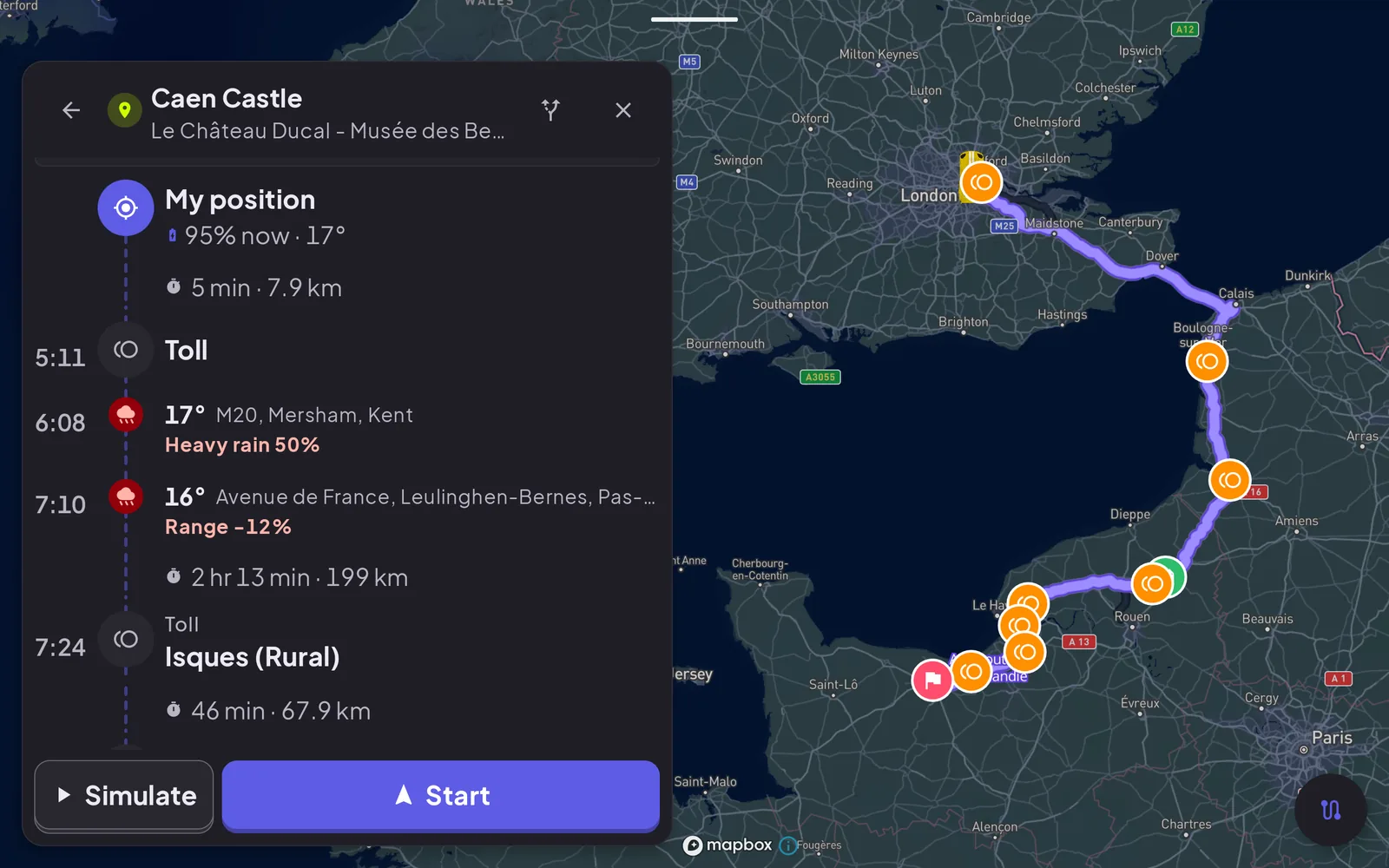
A map app that only gives you the fastest line is fine for a commute. On a longer trip, three other questions matter: what will the tolls cost, what will the weather be like when I get there (not right now), and will I make it on the charge. Cardashly's route planner puts those next to each other. This guide explains what it shows and how much to trust each number.
A note on cost: route weather and toll costs are Premium features in Cardashly. Basic turn-by-turn navigation with lane guidance is free.
Compare options before you start
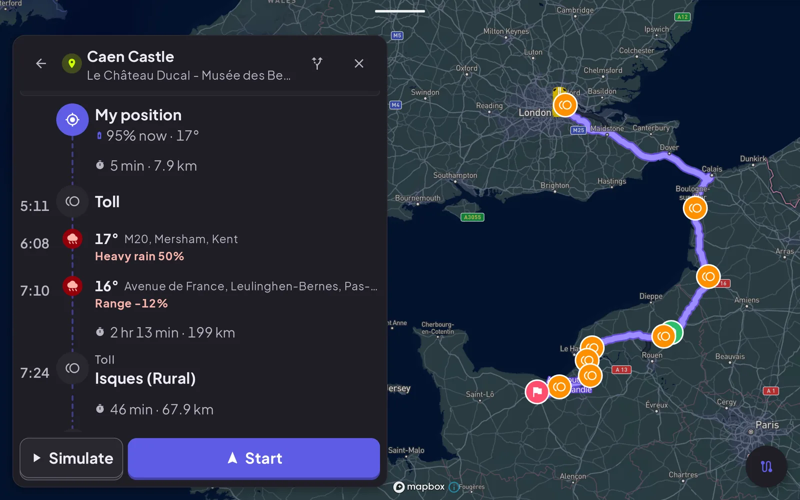
When you plan a destination, the app offers up to three routes and lets you step through them ("1 of 3", with previous and next buttons) or compare them side by side. Each option carries its own summary: duration, distance, how many toll booths it passes, and an estimated toll cost. One option can be labelled Least toll, which is handy when you would rather lose ten minutes than pay for the motorway.
Toll prices are marked with a tilde on purpose. They are estimates, and some are marked "rough". Where a toll booth offers a different price for a transponder or for cash, the timeline shows both, and says when the price is already included in the route total. Treat the figure as a planning number, not a receipt.
Telling the route what to avoid
In the planner's settings you can ask the route to stay off:
- Toll roads, highways, ferries or unpaved roads
- Tunnels
- Cash-only tolls (it skips plazas that do not take a card or transponder)
- Border crossings
- Roads other drivers have reported as flooded
The wording in the app is honest about the limit: avoided road types are things the route tries to stay off. If there is no other way, it still uses them, and it will say it cannot avoid everything you excluded.
Weather at the time you arrive
Most weather widgets show conditions where you are now. For a drive of several hours that is the wrong question. Cardashly samples the forecast at several points along the route and looks at the time you are expected to be at each point, then shows it on a strip and as markers on the map.
In the capture above, the timeline for a drive from London toward Caen lists a toll, then forecast rain further along the route, and then a toll near the end, with an estimated time beside each stop.
Forecasts get less reliable the further ahead they look, so a stop six hours out is a guide, not a promise. Re-check before a long leg.
The EV range hint, and why it says "rough"
For electric vehicles (set in your garage profile), the strip adds a small percentage showing how the conditions might change your range, such as "Range -12%" on a cold, rainy leg. It is worth being clear about what this is.
The estimate is a deliberately simple rule of thumb, not a battery model:
- Range is assumed to be best between about 15 and 25 °C.
- Below that, it falls by roughly 1.2% for each degree of cold, down to a floor.
- Above it, it falls by roughly 0.7% per degree for air-conditioning load, also with a floor.
- A headwind subtracts a little more and a tailwind adds a little, based on the wind direction relative to your heading.
- The total is kept within a believable range (never worse than -40%, never better than +10%).
The app labels it as a rough estimate for exactly this reason. Your car's own range figure, tyre pressure, speed and elevation will matter more than any of this. Use the hint to notice that a cold front is coming, then plan an extra charging stop with some margin.
What it does not do
It does not book anything, hold a toll price, or guarantee a charger is free. Charging stations are shown on the map, but availability is not something this view can promise.
If you are setting up the phone itself, start with how to turn your phone into a car dashboard. For the live engine data on the same trip, see connecting an OBD-II adapter.
Frequently asked questions
- Are the toll prices exact?
- No. They are estimates, shown with a tilde, and some are marked rough. Where a booth has different transponder and cash prices, both are shown.
- Does the route always avoid the roads I exclude?
- It tries to. If there is no other way it still uses them, and the app tells you it cannot avoid everything you excluded.
- Is the weather the forecast for now or for my arrival time?
- For the time you are expected to reach each point along the route, sampled at several places. Forecasts further ahead are less certain.
- How accurate is the EV range percentage?
- It is a rough rule of thumb based on temperature and wind, not a validated battery model, and it is labelled that way. Use it as a prompt to add margin.
Turn your phone into the cockpit
Cardashly puts a big glanceable speedometer, maps, music and one-tap calling on one dark, landscape screen, in any car. Free on Google Play.